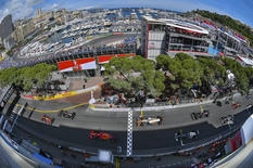
The Principality in three dimensions
The Government has launched a campaign to recreate the Principality through the most faithful digital representation possible, in high definition and 3D.
With vehicles equipped with dynamic scanners, on foot explorations using exoskeletons to capture the surroundings, thanks to 360° filming cameras for 'street view', drones capturing vertical images and rooftops, measurements by surveyors. All available means, from the most traditional to the most innovative, are being used to capture views of the Principality from every angle.
The first 3D recording campaign will take place from 15 to 19 April, during which time some of these innovative devices will be seen in the streets of Monaco.
A second campaign will take place in May.
The work undertaken by the Department of Forward Studies, Urban Planning and Mobility, in collaboration with the Digital Services Department, will result in the creation of a "digital twin" of the Principality, which will be superior to any other existing tool.
This virtual representation will enable government departments to work on urban development, plan the construction of new buildings, assess the suitability of renaturation projects, design pedestrian routes and many other projects that the Government may wish to undertake.
See also
Related news

Strengthened measures dangerous against dangerous driving by drivers of cars with large engines on the public roads

The ABB FIA Formula E World Championship

